
")


Great Smoky Mountains National Park Map (National Geographic Trails Illustrated Map, 229)
$14.95
Related Products
![Pisgah National Forest [Map Pack Bundle] (National Geographic Trails Illustrated Map)](https://i3.wp.com/m.media-amazon.com/images/I/41uAzBKYveL.jpg?w=300&resize=300,300&ssl=1)
![Appalachian Trail: Maine [Map Pack Bundle] (National Geographic Trails Illustrated Map)](https://i3.wp.com/m.media-amazon.com/images/I/41W3aY67iXL.jpg?w=300&resize=300,300&ssl=1)


![Linville Gorge, Mount Mitchell Map [Pisgah National Forest] (National Geographic Trails Illustrated Map, 779)](https://i3.wp.com/m.media-amazon.com/images/I/51I0rTcUZQL.jpg?w=300&resize=300,300&ssl=1)
![White Mountain National Forest [Map Pack Bundle] (National Geographic Trails Illustrated Map)](https://i2.wp.com/m.media-amazon.com/images/I/41nJ-o-1-bL.jpg?w=300&resize=300,300&ssl=1)
Price: $14.95
(as of Feb 27, 2024 15:29:48 UTC – Details)
• Waterproof • Tear-Resistant • Topographic Map
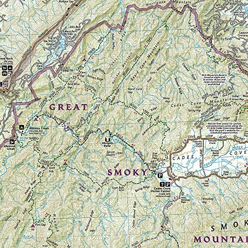
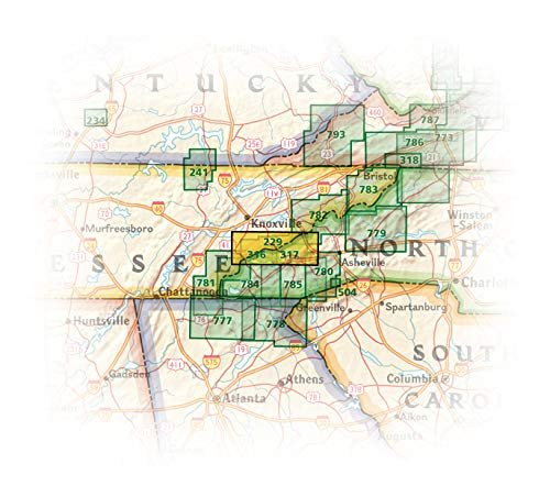
America's most visited national park and a UNESCO World Heritage Site, Great Smoky Mountains National Park is both renowned for its diversity of plant and animal life and rich in remnants of Southern Appalachian mountain culture. National Geographic's Trails Illustrated map of the park combines unparalleled detail and valuable information for outdoor enthusiasts seeking to explore all the area has to offer with particular attention shown to backcountry campsites, shelters, and stream crossings. A detailed profile of the Appalachian National Scenic Trail, which snakes along the ridge of the Great Smoky Mountains, provides a handy tool for hikers. The map features many key points of interest as well, including Cades Cove, Fontana Lake, Maryville, and Gatlinburg.
With over 800 miles of mapped trails, the Great Smoky Mountains National Park map can guide you off the beaten path and back again. The clearly marked trails include mileages between intersections. The map base includes contour lines and elevations for summits, passes and many lakes. Some of the many recreation features include: visitor centers, campgrounds, trail shelters, trailheads, boat ramps, scenic overlooks, interpretive trails and quiet walkways.
Every Trails Illustrated map is printed on “Backcountry Tough” waterproof, tear-resistant paper. A full UTM grid is printed on the map to aid with GPS navigation.
Other features found on this map include: Cherokee National Forest, Chilhowee Mountain, Clingmans Dome, Fontana Lake, Great Smoky Mountains, Maryville, Mount Chapman, Mount Le Conte, Nantahala National Forest, Newfound Gap, Old Black, Pisgah National Forest, Waynesville.
Map Scale = 1:70,000Sheet Size = 37.75″ x 25.5″Folded Size = 4.25″ x 9.25″
User Reviews
Be the first to review “Great Smoky Mountains National Park Map (National Geographic Trails Illustrated Map, 229)”
$14.95


There are no reviews yet.