
")

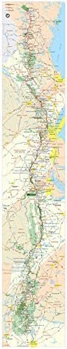


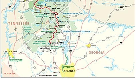
Map of the Appalachian Trail, 15 X 78 Inch Image (15 x 78)
$69.00
Related Products


![Green Mountain National Forest South Map [Robert T. Stafford White Rocks National Recreation Area, Manchester] (National Geographic Trails Illustrated Map, 748)](https://i2.wp.com/m.media-amazon.com/images/I/51kogy7LupL.jpg?w=300&resize=300,300&ssl=1)

Price: $69.00
(as of Feb 27, 2024 15:40:18 UTC – Details)
You can own this large, beautifully printed wall map of the Appalachian Trail, and use it to plan your next trip
Produced by the National Park Service and printed by ARThouse in Maryland; shows topography, park roads, and features
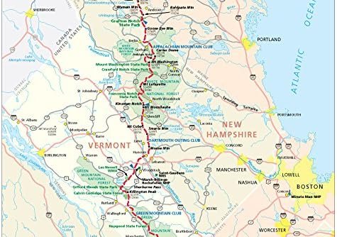
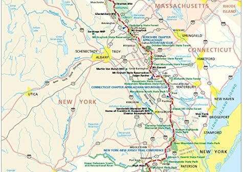
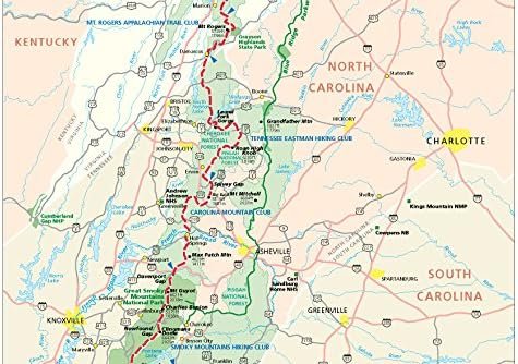
Exquisite detail; map can be mounted on Gator Board and used to plan your trip; additional images show more details of the trail from left to right
The image size of the map is very long, at 15 x 78 inches, plus a one inch white border; it will come rolled in a sturdy tube
The map is printed on heavy weight acid-free paper using fade-proof inks; a collector's item suitable for framing


There are no reviews yet.