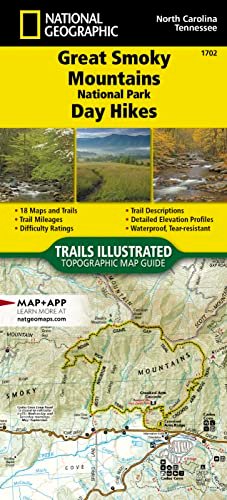
Price: $14.95
(as of Feb 29, 2024 17:58:33 UTC – Details)
• Waterproof • Tear-Resistant • Topographic Map
The Great Smoky Mountains are named for their thick morning fog, and Great Smoky Mountains National Park is known for its abundant biodiversity, its magnificent waterfalls and its strong southern Appalachian mountain culture. The park is home to over 850 miles of hiking trails meandering up and over ancient mountains ranging from 875-foot valleys to 6,643-foot peaks.
The Great Smoky Mountains National Park Day Hikes Topographic Map Guide includes eighteen diverse hikes for all outdoor enthusiasts, from the easy, 3.5-mile Andrews Bald Trail to the strenuous, 11.5-mile Lakeshore-Shuckstack Loop. Each hike has a detailed map, a trail profile visualizing the changes in elevation, and a short summary of the interesting features encountered along the trip.
Some of the must-visit sites in this Topographic Map Guide are: Rainbow Falls—the highest single-drop waterfall in the Smokies, Chimney Tops—one of only a few peaks in the Smokies with bare rock summits, and Meigs Creek Trail—which crosses the creek almost twenty times without bridges and passes the 18-foot Upper Meigs Falls.
More convenient and easier to use than folded maps, but just as compact and lightweight, National Geographic’s Topographic Map Guide booklets are printed on “Backcountry Tough” waterproof, tear-resistant paper with stainless steel staples. A full UTM grid is printed on the map to aid with GPS navigation.
Map Scale = 1:50,000Folded Size = 4.25″ x 9.38″
From the Publisher
Curating the National Park hiking experience


Each book features 16-18 great day hikes with mileage, elevation profiles, points of interest and directions to the trailhead.
The National Park Day Hikes booklets provide a curated collection of maps and information for a diverse selection of day hikes in each national park, carefully selected and mapped by the cartographers and outdoor experts at National Geographic, with park managers’ input. They’re designed for quick and convenient access to the information needed for trail discovery, selection, and navigation within national parks.


Along the bottom of each map is a trail profile showing elevations, landmarks, trail junctions, and distance intervals keyed to the map, along with GPS coordinates and directions to the trailhead.


Convenient, lightweight, and durable booklet format
More convenient and easier to use than folded maps, but just as compact and lightweight, the booklets are printed on waterproof, tear-resistant paper with stainless steel staples. The format is perfect for casual exploration of National Parks through day hikes.
Region
California Wyoming, Montana, Idaho Wyoming Colorado
Region
North Carolina, Tennessee Virginia Texas Arizona
Publisher : Natl Geographic Society Maps; 2023rd edition (January 1, 2023)
Language : English
Map : 48 pages
ISBN-10 : 1566958016
ISBN-13 : 978-1566958011
Item Weight : 2.82 ounces
Dimensions : 4.1 x 0.2 x 9.2 inches
User Reviews
Be the first to review “Great Smoky Mountains National Park Day Hikes Map (National Geographic Topographic Map Guide, 1702)”

$14.95


![Pisgah National Forest [Map Pack Bundle] (National Geographic Trails Illustrated Map)](https://i3.wp.com/m.media-amazon.com/images/I/41uAzBKYveL.jpg?w=300&resize=300,300&ssl=1)
![Appalachian Trail: Maine [Map Pack Bundle] (National Geographic Trails Illustrated Map)](https://i3.wp.com/m.media-amazon.com/images/I/41W3aY67iXL.jpg?w=300&resize=300,300&ssl=1)
![Linville Gorge, Mount Mitchell Map [Pisgah National Forest] (National Geographic Trails Illustrated Map, 779)](https://i3.wp.com/m.media-amazon.com/images/I/51I0rTcUZQL.jpg?w=300&resize=300,300&ssl=1)
![White Mountain National Forest [Map Pack Bundle] (National Geographic Trails Illustrated Map)](https://i2.wp.com/m.media-amazon.com/images/I/41nJ-o-1-bL.jpg?w=300&resize=300,300&ssl=1)
There are no reviews yet.